Main | Books | What's New | Contact Us
How To Order

Travel Maps

Shearer Publishing is pleased to announce that Mapsco, Inc. has purchased our entire line of state road atlases. Please contact Mapsco directly at:

Mapsco, Inc.
4181 Centurion Way
Addison, TX 75001
972.450.9300
www.mapsco.com


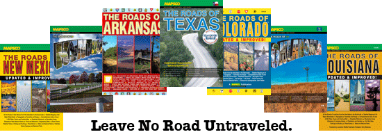
Each road atlas in this series is a convenient one-volume set of detailed maps covering the state's entire road system - from interstates to county roads. Based on county maps from state highway departments and other sources, these atlases contain up-to-date and accurate mapping information available for that state.

In addition to roads, the maps show state and national parks and other recreation areas, river and lake access, mountain peak elevations, military bases, airports, railroad lines, and bridges. In rural areas churches, cemeteries, historic sites, and other landmarks are shown, as well as small communities not usually found on most road maps.

A section in each atlas lists roadside attractions, annual events, and other information to enhance the pleasure of traveling in the state. Color illustrations by regional artists depict some of the state's indigenous flora and fauna.


Maps available for...

The Roads of Texas is a convenient one-volume set of detailed maps covering the entire road system. All of the roads are labeled, including county roads where information was available.

ISBN 0-940672-64-2
176 pages, 11x15 3/8
149 map pages
$14.95

The Roads of Colorado atlas has 147 full-color map pages that show townships and range, contour lines at 50 meters, private, state, and federal land boundaries color-coded. All roads are labeled. Scale is 1" = 2.5 miles.

ISBN 0-940672-59-6
168 pages, 11x15 3/8
147 map pages
$16.95

The Roads of Louisiana is a large scale state road atlas, covering the interstates to the backroads. Scale is 1" = 2.5 miles. The atlas contains full color maps, topography, water features, road surface definition, latitude and longitude lines, townships and range, and a comprehensive index of more than 2,700 cities, towns, and communities.

ISBN 0-940672-69-3
104 pages, 11x15 3/8
74 map pages
$16.95

The Roads of Oklahoma is a large scale state road atlas, covering the interstate to the backroads. Scale is 1" = 2.5 miles. Contains full color maps, topography, water features, road surface definition, latitude and longitude lines and townships and range.

ISBN 0-940672-67-7
128 pages, 11x15 3/8
$16.95

The Roads of New Mexico atlas has 110 map pages covering the entire New Mexico road system. Based on the New Mexico State Department of Transportation maps.

ISBN 0-940672-52-9
128 pages, 11x15 3/8
110 map pages
$14.95

The Roads of Arkansas atlas is a convenient, one volume atlas containing 110 map pages of the entire road system. Based on the Arkansas Department of Transportation Maps.

ISBN 0-940672-53-7
123 pages, 11x15 3/8
110 map pages
$13.95

The Roads of North Carolina atlas, based on county maps from the location and survey unit of the North Carolina Department of Transportation, has 64 map pages detailing all of the roads in North Carolina.

ISBN 0-940672-48-0
80 pages, 11x15 3/8
64 map pages
$12.95


Shearer Publishing 406 Post Oak Road Fredericksburg Texas 78624
Call Us Toll Free 1-800-458-3808
E-mail
shearer@shearerpub.com
Copyright © 2005 Shearer Publishing. All rights reserved.
Page Design by
Home Page Express